

Abstract
This article looks at Indian space program and its implications for various countries of the region. Dual use nature of space assets and platforms are discussed to outline the quantum of space developments in India. Indian hegemonic designs thru force projection using aerospace power are argued based upon available public domain information. And at the end possible response measures for smaller regionaborsa prima classe uberlube luxury lubricant blundstone uomo oregon football jerseys jock strap custom kings jersey adidas yeezy boost 350 turtle dove alpinestars caschi latex hood deuce vaughn jersey deuce vaughn jersey custom stitched nfl jersey fsu football jersey decathlon bmx uberlube luxury lubricantl countries are also suggested.
Keywords
Aerospace power, Space Technologies, Indian Space Research Organization (ISRO), Power projection, Indian Hegemony
Introduction
India has been developing its space program ever since formation of “Indian National Committee for Space Research” (INCOSPAR) in January 19621. What characterizes Indian program is its continuity and an upward progress ever since. It launched its first rocket only after three years of commencement of work and now owing to her economic growth, India is continuing the broad-based space program that includes indigenous launch vehicles, artificial satellites, control facilities, and data processing. The launch of its first satellite with assistance from the then Soviet Union in 1975, subsequently its first domestic spaces launch in 19802 proved it as a true space-faring nation. Today the Indian communications, meteorological and remote sensing satellites are comparable to any other advanced country. At present India is counted in the first six most developed nations in space technology with a geostationary launch capability. Currently Indian space technology development has reached a stage where landing on the moon is being planned and worked-upon actively. India is going to be the fourth country after the US, Russia and China to send a man into space3.
Space Program and Developments
India not only boasts mastering these technologies but also is operating all these types of space platforms. The development of the sensors and payloads is being done in Ahmedabad. The design, development, assembly, and testing of satellites is the responsibility of ISRO Satellite Center (ISAC) in Bangalore and the launch vehicles is the task of Vikram Sarabai Space Center (VSSC) at Thiruvananthapuram whereas Satellite launching takes place from north of Madras, ‘Sriharikota High Altitude Range’ (SHAR). Similarly, Liquid propulsion modules including cryogenic engines are developed at the Liquid Propulsion Systems Center located near Thiruvananthapuram a place near Bangalore provides the Master Control facilities for satellite station. The reception and processing facilities for remote sensing data are available at National Remote Sensing Agency (NRSA) in Hyderabad. These important facilities enabled India to attain a prominent place in space-faring nations.
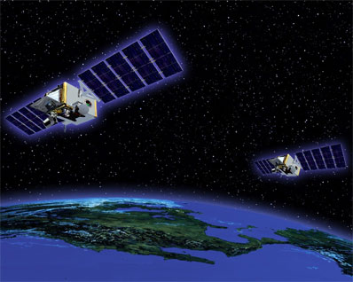
India is building up a satellite-based Military Surveillance and Reconnaissance System since 2002 which was supposed to be operational by 2005. In 2001, ISRO launched Technology Experiment Satellite (TES) having resolution of 1-M that fulfills most of military reconnaissance needs4. These satellites could produce reliably high-quality images of the Afghan war and of Pakistani troop movements. Subsequently Cartographic Satellite series (CartoSat) achieved resolution of 0.5 M that could meet almost all military needs. In April 2009, India launched a satellite capable of reading number plate of cars, which can rightly be called as a spy satellite.5 In 2013 the Indian military launched its first exclusive military geostationary satellite GSAT-7 with advanced capabilities and planned usage by Indian Navy and Army6. GSAT-7 will be followed by another satellite GSAT-7A, exclusively for IAF communications requirements. As per officials of Indian MoD it would be launched within 2017.7 Another critical capability in space domain is country’s own satellite based navigation system. In April 2016 by launching the last of seven satellites, India has operationalized8 IRNSS (Indian Regional Navigation Satellite System) which provides battlefield satellite navigation to Indian armed forces and allows employment of precision guided weapons. All these recent developments put IAF on a road to become true Network Centric Aerospace power9.
Aerospace Command
India began planning a constellation of high-resolution satellites for tactical military applications after an inquiry into the failure of Indian remote sensing satellites to detect infiltrators from Pakistan in the Kargil area in May 1999. Then it was further established that they failed to detect the camps Pakistan had set up in their area. The committee observed that “intrusions could have been detected earlier if India had half-meter resolution satellite imagery. The satellite imageries available within the country were of a lower capability”.10 On the other hand, the importance of satellite information to the success of U.S military operations in Afghanistan and Iraq have strengthened India’s resolve to set up an Aerospace Command, its Air Force could use it to operate dedicated military satellites.11 The concept of Aerospace Command was conceived in 2000 and India’s Air Force (IAF) officials envision an aerospace power instead of airpower as its function. Indian Air Force is working to augment the automation process of the data being received through existing channels and civilian surveillance and reconnaissance satellites at the headquarters of space technologies that will help link radar and communications networks and be used for ballistic missile defense and intelligence gathering. The IAF has, for some time been demanding the creation of an integrated aerospace command as conceived to boost the tactical and strategic capability of Indian armed forces. The IAF’s “Defence Space Vision 2020” outlines a strategy for the optimization of space assets for sharpening the combat preparedness.12 In the backdrop of these rapid developments, Indian space command would soon be a reality.
Implications for Regional Countries
It is widely acknowledged that all future wars would be much different from past wars fought in the era of predominantly land or naval strategies, and that the medium of air and space would play the most significant role in future wars. Space power would play a crucial role in shaping and determining the outcome of any conflict. Aircraft carriers, though part of naval power, are essentially the means to carry airpower as nearer the target as possible to extend projection of force to further distances. Aerospace assets provide essential elements for effective and meaningful integration and employment of these naval and air assets.
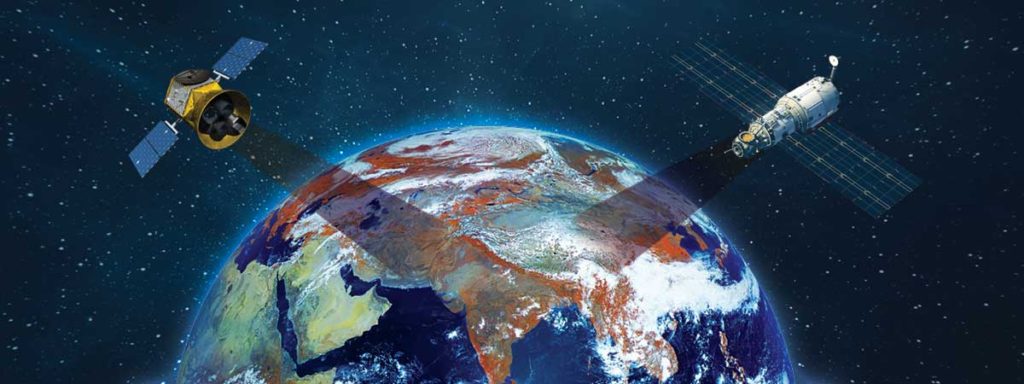
It has far reaching implications for Pakistan and other regional countries. Missile launches by Indian rivals, such as Pakistan and China, may be monitored by Cartosat-2A, which carries an advanced Synthetic Aperture Radar (SAR) created by Israel and a high digital resolution camera capable of detecting missile launches.13 Pakistani nuclear deterrence capability is heavily impacted by the capacities of Indian satellites. Since India will have such an extensive coverage of Pakistani military systems, hence, they may be able to counter Pakistani military operations with ease. For instance, India was able to discover and study Pakistan’s missile forces through Indian satellites, which directly affect Pakistan’s ability to escape the Indian first strike, a factor which weakens Pakistan’s deterrence and might consequently resort to a pre-emptive first strike of its own. Although the counter logic that deterrence, in a way, has further enhanced owing to the ability of Indian to confirm the preparation of strategic missile strike through satellite monitoring well before it is communicated. India’s satellite intelligence capabilities also enhance provisioning of accurate tactical and strategic information on Chinese military forces in Tibet. Satellite reconnaissance would give Indian armed forces sufficient early warning about the enemy movements and thereby aiding the deployment of its forces in time to counter properly the impending threat. Similarly India can have robust and accurate Recognized Air Maritime Picture (RAMP) of complete Indian Ocean, which can potentially limit Pakistan’s Navy maneuvers. Possible detection of submarines movements by high resolution military satellites under certain conditions like when moving in shallow waters at high speeds or while snorkeling14, may also be important factors in regional strategic calculus.
Besides implications for individual countries, India is looking at herself as a global power capable to project its power beyond its own territory. Indian intent to be the preeminent power between the Persian Gulf and the Malacca Straits is very clear.15 Under an agreement between India and Qatar, New Delhi would protect assets and interests of Qatar from external threats but the agreement stops short of stationing troops. As India acquires greater power which protects her interests in the region she would go for such agreements with other regional countries as well, even to the extent of having permanent forces deployed at various places in the region. Infrastructure development by the Indians is being made in accordance with the envisioned great-power role. This includes efforts like forward basing of aerospace assets in future through defence pacts. Development of space technology to provide strategic surveillance and intelligence that enables India to watch over the areas of interest, together with full command and control capability for power application at distant places. The Indian power projection development, defence pacts aimed at assuming responsibility to protect the interests of other nations, and support of the US and Israel will enable India to achieve the grand objective of becoming the regional power player and implement its hegemonic designs in the region.
Response
Nations located in the region that exists within the threat radius of Indian power projection capability would certainly require comprehensive measures to thwart the possible threat to their respective national interests. The external threats to one’s national interests are numerous when seen in the light of the emerging concept of comprehensive security. The regional or global powers dictate their terms to the target country, exerting ever greater political pressure in order to cause the intended behavioral changes in line with their interests.
Response options available with smaller nations can be classified as response at broader national level and measures specifically aimed at blunting the enemy ever-increasing space power. Countermeasures against Indian space program can be further divided into active and passive measures. Adoption of proper camouflaging techniques keeping in view characteristics of spy-satellites, concealment and deception using decoys, and planning and managing the movement of friendly forces taking into account number, type and revisit time of enemy satellites are some of passive techniques which can be adopted as countermeasures16. Usage of alternate satellite navigation systems as backup to existing GPS should be considered for military purposes, while developing one’s own satellite navigation system (may be at smaller scale limited to country or region only). During critical stages of a conflict active-measures such as targeting enemy satellite ground stations and anti-satellite weapons (ASAT) can also be possible options of last resort. However development of anti-satellite weapons (ASAT) would entail implication at international-level due to various agreements regulating usage and militarization of space.17 Such active measures would also require considerable amount of development and technological sophistication, which should be pursued on long-term basis.
At regional level increasing the awareness about the threat posed by Indian space program and her hegemonic designs is of prime importance. The smaller nations must consider certain safeguards at national-level against hegemonic designs of adversary by developing their own space program with minimum essential capabilities. While remaining effective in the global affairs, they must manage the avoidance of conflict. This consideration must be kept at the heart of national strategic planning. The punch line is that such nations should have the superior diplomatic behavior that could compensate for the existing inadequacies in defence capabilities. Additionally, the smaller nations must also work to achieve better security guarantees by working to change the world security arrangements. The experts recognize that small powers could avoid the harmful influence of great powers by marshalling votes rather than guns against it. In this way, small powers alliances augment the political potential with improved prestige, influence and bargaining capability.18 A multi-pronged and long term efforts are required by Pakistan and all regional countries to thwart Indian designs.
End Notes
1The dates of the of the first indigenous space lunch was retrieved from “ISRO” http://www.isro.gov.in/about-isro/isros-timeline-1960s-to-today#0 accessed on 7 January 2017
2Ibid
3“India takes giant step to manned space mission” http://www.telegraph.co.uk/news/worldnews/asia/india/11305062/India-takes-giant-step-to-manned-space-mission.html accessed on 16 January 2017
4“Military Dimensions of the Indian Space Program” Tylor & Francis, accessed on January 16, 2017, http://www.tandfonline.com/doi/full/10.1080/14777622.2013.842453?src=recsys
5Zahid Ali Khan, “Development in Indo-Israel Defence Relations Since 9/11: Pakistan’s Security Concern and Policy Options,” South Asian Studies 26, no.1 (January-June 2011): 131-151, accessed on 8 Jan 2017, http://pu.edu.pk/images/journal/csas/PDF/9-Dr.%20Zahid%20Ali%20Khan.pdf
6“GSAT-7 to boost India’s military capabilities” http://timesofindia.indiatimes.com/india/GSAT-7-to-boost-Indias-military-capabilities/articleshow/22158766.cms accessed on 8 Jan 2017
7“India’s Tech Roadmap” http://defence.pk/threads/indias-tech-roadmap-points-to-small-sats-space-weapons.276947/#ixzz4VH0hF7dH accessed on 9 January 2017
8“India gets its own GPS” http://www.business-standard.com/article/current-affairs/india-gets-its-own-gps-with-successful-launch-of-7th-navigation-satellite-116042800308_1.html accessed on 28 February 2017
9“Indian Air Force fast becoming an Aerospace Force” http://defencenews.in/article/Indian-Air-Force-fast-becoming-an-Aerospace-Force-8626 last accessed on 28 February 2017.
10Padma Tata, “New Indian satellite could provide military surveillance,” New Scientist, October 23, 2001, accessed on January 8, 2017, http://www.newscientist.com/article/dn1463-new-indian-satellite-couldprovide-military-surveillance.html
11Arun Sahgal and Vinod Anand, “Revolution in Military Affairs and Jointness,” Journal of Defence Studies 1, no.1 (2007): accessed on January 8, 2017, http://www.idsa.in/jds/1_1_2007_RevolutionInMilitaryAffairsAndJointness_ASahgal and also see Donald H. Rumsfeld and Stephen A Cambone, “Enduring Issues: The Space commission 10 years later,” The Journal for Space and Cyberspace Professionals 7, no.4 (August 2011): 3, accessed on January 8, 2017, http://www.afspc.af.mil/shared/media/document/AFD-110825-027.pdf
12Radhakrishna Rao, “Need for an Indian Aerospace Command; now and here,” Vivekananda International Foundation, accessed on January 8, 2017, http://www.vifindia.org/article/2012/april/11/need-for-anindian-aerospace-command-now-and-here
13 “CARTOSAT-2A Remote Sensing Satellite, India”, accessed on January 16, 2017, http://www.aerospace-technology.com/projects/cartosat-2a/
14“Detection of Submerged Vessels Using Remote Sensing Techniques” by By G.G.Wren,and D.May,RAAF Australian Defence Force Journal No 27 November/December 1997
15“Indian defence pact with Qatar,” The Hindu, accessed on January 16, 2017, http://www.thehindu.com/todays-paper/India-signs-defence-pact-with-Qatar/article15339559.ece
16“Importance of satellites in Maritime Domain” http://newyorkessays.com/essay-importance-of-satellites-in-maritime-domain-2/# accessed on 12 January 2017.
17Still All Quiet on the Orbital Front? The Slow Proliferation of Anti-Satellite Weapons. by STRAUCH, Adam published in Obrana a strategie. 2014, roč. 14, č.2, s. 61-72. ISSN 1802-7199. DOI: 10.3849/1802-7199.14.2014.02.061-072
18Robert L. Rothstein, Alliances and Small Powers (London: Columbia University Press, 1968), 173.